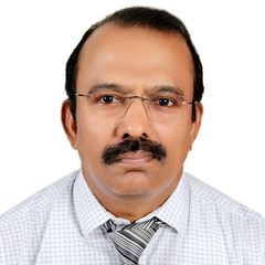
Engineering Services Lead
Qatar Petroleum
Total years of experience :28 years, 7 Months
Engineering Services Lead
RLC AutoCAD, Land Survey Coordinator (prev)
RLIC-GIS Coordinator(prev)
Section Head for Survey / CAD / GIS and Asset Tag numbering Engineering Services of Industrial Cities QP-RLIC.
It is a challeging job catering to various engineering services requirements of Projects, Development Planning and Operations at RLC, MIC and Dukhan.
Developed RLC GIS from scratch & implemented. Conducting topographical surveys, Preparing various maps, Drafts engineering drawings and Provides engineering equipments asset numbers as per Engineering standards, reviews project submittals, allocates land parcels, monitors the landuse and land leases.
Supervising and guiding Design Engineers, Land Surveyors and CAD Draftsmans and GIS Analists.
Supporting all IC Departments/Endusers/Contractors on Survey / CAD / GIS Eng. Services requirements.
Provided support services to over 300+ QP contract projects on CAD, GIS, Asbuilt/Topo Land Survey and Asset Tagging.
Asset Tag numbering of all QP projects for SAP maintenance, PCR/MOC drawing preparation as per engineering standards
Technical review of project contractors report submittals CAD drawings, Survey Reports, Geotechnical Reports, GIS Geodatabase, GIS Land Lease Allocations, Geoprocessing, Remote sensing analysis, Utility/pipe Corridors crossings, Aerial Survey/Mapping projects, Bathymetric Survey reports, Conceptual Planning drawings of projects, Work Permit reviews. Major Endusers corridors/plots survey drawing reviews.
Developing, updating, monitoring ArcGIS Applications for RLIC, Autherising RLC GIS maps, continual updation of ArcSDE Geodatabase.
Continual technology software/hardware updates on ArcGIS, AutoCAD, RTK GPS Survey.
Review and Support on RLC Engineering work flow Procedures and Standards.
Participating Conferences/workshops and presenting GIS Papers on Utilities, Oil&Gas, Environment, etc.
Facility Management System for Etisalat’s Inside Infrastructure using AutodeskMap.
Project Execution for clients using ArcGIS, 3D GIS, ArcScene, ArcView 8, ArcEditor, ArcSDE, GeoDatabases, PromptServer, PromptInfo etc.
Creating Geodatabase Schemas, Migration of ArcInfo data to ArcSDE Geodatabase.
Updation of ArcInfo Coverages using latest image data.
Technical Proposals and cost estimation for Tender responses.
GIS - Analyst / Co-ordinator. SSI, Doha - Qatar.
Conducted user need studies,
Drafted user need study report and GIS projects
Discussions with various Dept. divisions for GIS usage.
GIS - Division setup and installing ESRI products
Development of Customised Map Display, Plotting and Query information system using ArcView and Avenue, Developer 2000.
Development of Customised Map Display and Query information system using VB and MapObjects, Sql, ODBC, ADO.
Development of Building Information System for Security.
Software used Arcinfo 7.0, 8.0, Arcview 3.2, 8.0, Autocad R14, MS Access
Landmark Locations using GPS and transforming data to Arcinfo
Crime Mapping and Analysis using Arcview / Avenue and Oracle / Developer 2000
Crime Mapping and Analysis using VB and MapObjects, Sql, ODBC, ADO.
Security Map Maker for International conference/event in Doha using ArcInfo / Arcview / Avenue
Ahmedabad Municipal Corporation (AMC ) GIS pilot project:
ROLE : Project Leader
The Project involved development of Landbase maps, with water supply and drainage network utility, the Arcinfo network modal was created and database from field book was entered into the system. The water supply maintanance departments user needs were developed using Arcinfo, Arcview, Autocad, Oracle, Developer 2000.
BELL Canada AM / FM / GIS Telephony project:
ROLE : CableCad / IMAP Technical Consultant & Training Leader
Objective : Technical consultancy & Training of personals to data capture from various telephony records such as, Conduits, Ducts, Cable and Dip plats, attaching database to various outside plant items. To Build network connectivity logic and substantial customisation in the base GIS software. To maintain stringent quality level. The project was done in CableCad and IMAP software running on OS/2 platform.
In House GIS -Utility Project for a huge industrial campus:
Company : Larsen and Toubro Limited, Powai, Bombay, India.
ROLE : Project Leader
Objective : To build GIS for industrial campus.
Software: Arcinfo 7.0, Arcview, Autocad, MS Access.
Bombay Electric Supply and Transport (BEST) Electrical Network Project:
Role : Project Leader
The Project involved building a spatial electrical database for a part MSEB Electrical Network. The Base maps were digitised using Autocad, Cadoverlay, Landbase coverages and Electrical Network coverages were created using Arcinfo, the electrical detais for equipments were entered into the system using MS Sql and VB Forms.
ESRI Map Digitisation project:
Company : ESRI, Redlands, USA.
ROLE : Project Leader
Objective : To get registered as an authorized ESRI's sub-contractor for Parcel Map Digitisation. Several adjoining parcel maps were scanned, digitised, mosaiced and data base attached as per the quality need ESRI Certification.
Development of PC based GIS package 'Geo-Referenced Area Management (GRAM)' for Department of Science and Technology, New Delhi.
Objective : Development of a PC based GIS package called Geo-Referenced Area Management (GRAM) and the Development of Kheda district GIS Database application.
Software: Pascal, Fortran, GRAM, IP Tools.
Forest and Environment Monitoring GIS:
Sponsor Ministry of Forest and Environment, New Delhi
Role: Research Scientist
Objective: Developing GIS for forest and environmental monitoring of Goa and Bailadila region, using satellite imagery and ground collected data.
The work involved preparing thematic maps for forest using temporal satellite images, digitising of species polygons, water resouces, coup boundaries, block boundaries, Landuse, harvesting, felling coup, thinning policy etc. Various attributes were added. Spatial analysis and change detections were performed and the system was customised using Arcinfo and Arcview.
Multilevel data integration using GIS:
Sponsor : Rajasthan State Mines And Indian Institute of Technology, Bombay.
ROLE :Senior Research Assistant
Objective : Integration of mineral exploration data, Remote sensing data and statistical data to demarcate 'Suphide Mineralised zones' in Rajasthan State.
Software: Arcinfo, Pascal, Fortran, GRAM, IP Tools.
Senior Research Assistant, IIT Bombay
Environmental Impact Assessments using Remote Sensing and GIS:
Sponsor: Ministry of Environment and Forest, New Delhi. And Indian Institute of Technology, Bombay.
ROLE : Senior Research Assistant
Objective : Environmental Impact Assessments for Iron ore mines in Goa and Madya Pradesh States through GIS using Aerial Photographs, Remote sensing data and mining field data.
Software: Pascal, Fortran, Idrisi, GRAM, IP Tools.
Mapping, Remote Sensing, GIS, Programming